My wife wanted to show me Ly Son Island--an island off of Quang Ngai which she said was quite lovely in summer.
In order to get one of the earliest ferries, we spent the night in the port town of Sa Ky.
(View from the motel window)

and then we got the ferry to the island.

The ferry took 45 minutes to the island, and then we landed at the port.
Port View
We found a hotel on the island and settled in.
My wife told me that the island only got electricity 4 years ago, and so has only recently started becoming a popular tourist destination. But since that time, lots of hotels now are beginning to pop up.
We stayed at the Central Ly Son Hotel.
My wife, who had been on this island before, told me that there were some sights to the east of the island and to the west. The ones to the east were just a short walk away. So we headed off following the coast road.


Neither of us had remembered to bring sunglasses, although we both had sun hats. I had thought the shading of my hat would be enough protection from the sun, but this turned out to be a mistake. Walking along the coast, the sun was so bright that it was painful.
There was a temple on a hill along the coast.


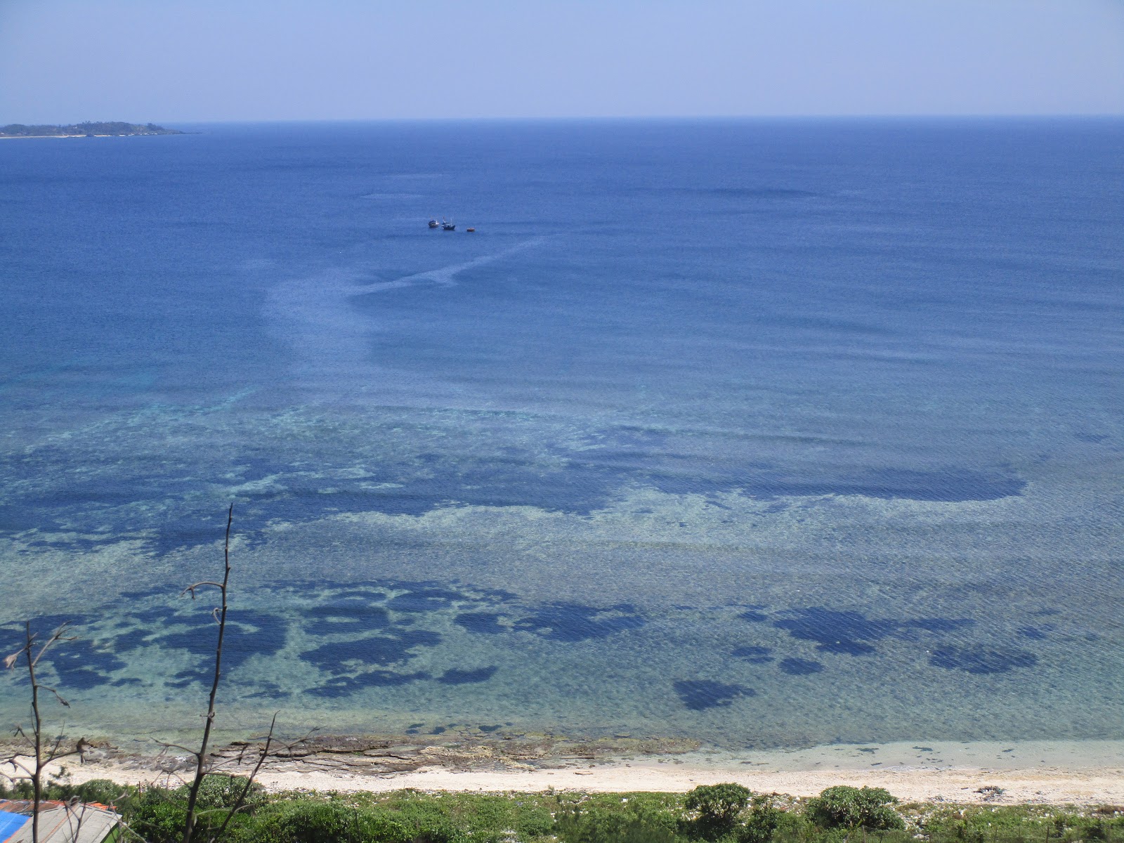
The next stop was a scenic spot with some rocks and coral on the beach.


There was an archway in the rock, which my wife told me was known as "the gateway". At sunset, you could see the sun setting framed by the archway (unfortunately we never returned here for sunset, but if you search Ly Son Island on Google Images, you can see lots of pictures of sunset through this rock.)


The water was clear and beautiful.


Next was a giant statue of Buddha.
Apparently this was only just built in 2008, so that somewhat diminished from its awe as an historical artifact. But it was still impressive.


Behind the statue was a series of steps leading up the mountain. From the mountain, I took pictures of the view:
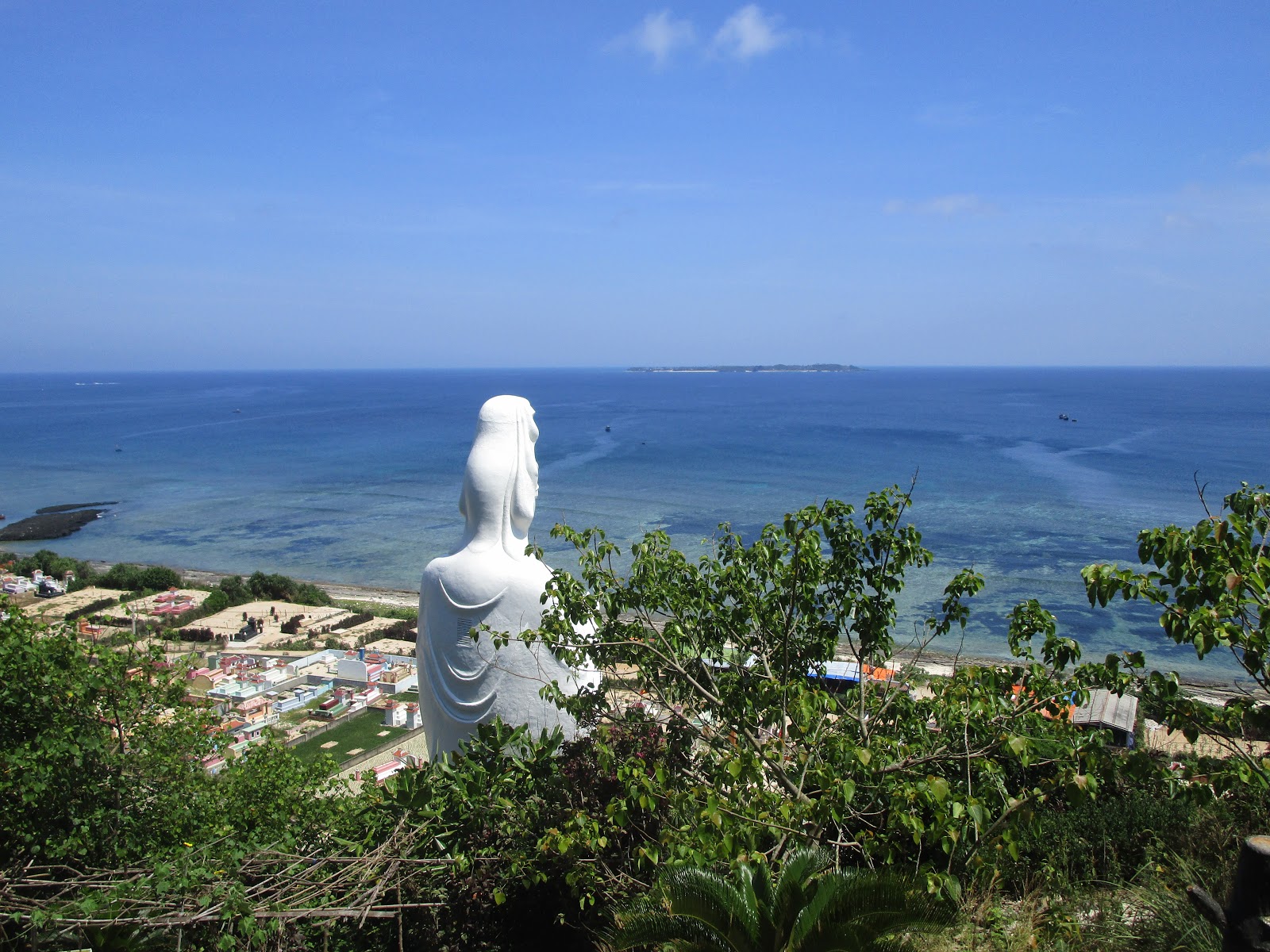


I got slight vertigo looking down at the Buddha Statue. I think because the statue was so big, that looking down on it helped put into perspective how high up I really was.

We walked back along the coast:


The sun and the heat had drained our energy. My wife went back up to the hotel room to sleep, while I got coffee and water at the hotel cafe.

After we had both recovered, my wife wanted to go see the sights on the west side of the island.
"But taxis are really expensive here," she warned me. "They're like twice the price on the mainland."
"We don't need a taxi," I said. "How big is this island? We can walk it."
My wife pulled up the information on Google Maps. (Google Maps is everywhere now. Even on remote islands in the middle of nowhere in Vietnam.) "It says it will take an hour and a half to go there," she said.
"An hour and a half! We can totally walk that," I said. "What else have we got on today's schedule anyway besides walking around the island."
...and so we set off along the coastal road towards the Western Half of the island.


After walking for almost an hour, we got to the 4 star hotel on the other side of the island.
This is a luxury hotel, newly built (my wife tells me) and is part of the rapid transition this island is now making to becoming a popular tourist destination.

There was a well near the hotel, with a historical marker near it. Indicating that it must be of some importance. But there was no other information given, and my wife didn't know anything, so I just took a quick picture and we walked on.

I was a bit curious about the history of the island. How long had it been settled? Were the Chinese here before the Vietnamese, or had it always been Vietnamese?
There were a few historical markers for temples, but no dates given to give me an idea of the history (at least none in English).
I tried to ask my wife, but she quickly stopped me. "Don't even try to ask me anything about the history," she said. "I don't know anything."
(On the following day, I did run into one older man, who told me that during the Vietnam War, the U.S. helicopters used to bring the soldiers out to the islands for swimming and relaxation. But that's all the history I was able to get during my two days on this island.)
Walking on...


We came upon a church, which (agnostic though I am) struck me as looking very picturesque out among the palm trees. I tried to get a good picture of it, but since we were coming along the coastal road, we were coming up behind it. I tried to get to the front of it, but couldn't find a path through to the front entrance.
(In the evening, after the sun went down, we would go back down a different road, and I did see the front entrance then. But at that point it was too late to take a picture.)
"For such a small island, there's a lot of religious buildings," I said to my wife. "We've already passed several temples, and now here's a church. Are there enough people on the island to support all these places of worship?"
My wife guessed that Christianity must be new to the island. "Probably someone from the island went to the mainland, and got married to a Christian," she said. "Then when they came back to the island, they had the church built."
Well, who knows. The church building did look new, although the fence surrounding it looked very old.


And more Buddhist Temples


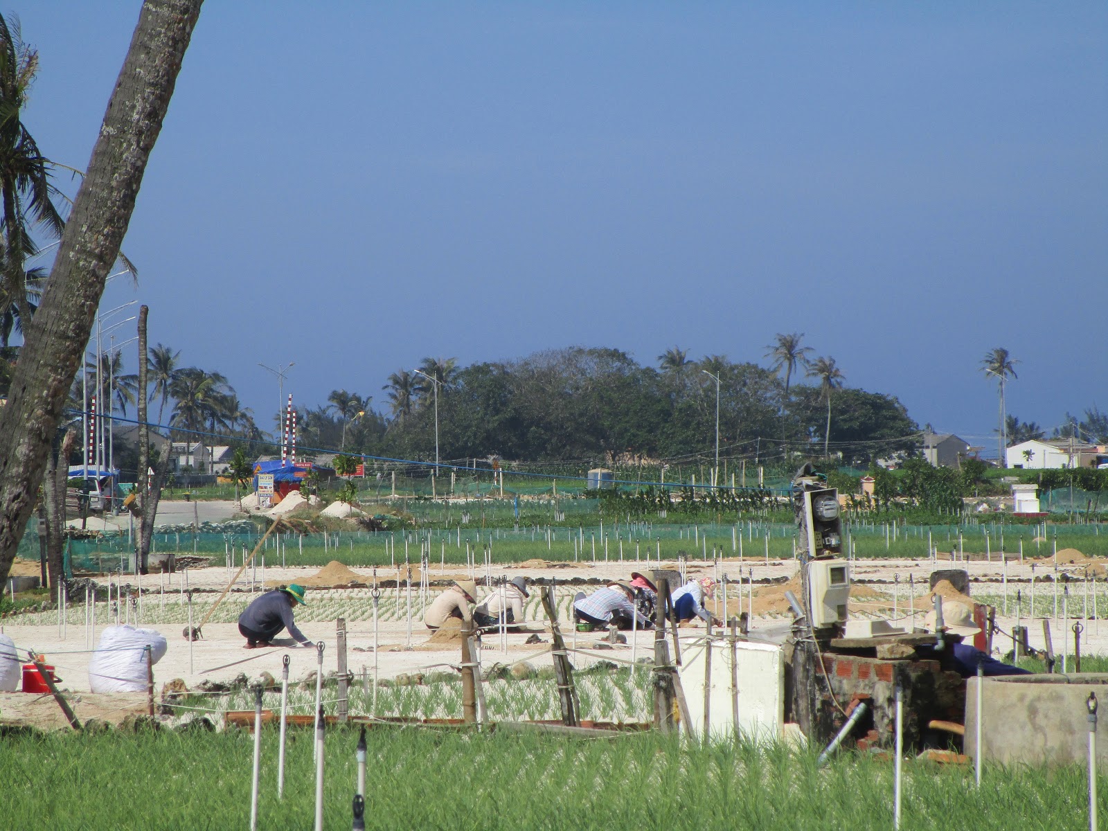
As we got to the west end of the island, we followed the road slightly inland. We passed a lot of agricultural fields. My wife told me that the island was famous for growing garlic and onion, and we saw a lot of that being grown in the fields. (Apparently garlic and onion grows in the sand, so it was unsuitable to be grown in the rice fields back on the mainland. The islanders grow garlic and onion, which they sell to the mainland, and then import rice in return.)


Eventually we got to the tourist destination, named Hang Cave.
There was a parking lot there were some other tourists had driven up in cars or mini-buses.
We walked along the beach.


There was not just one, but two couples getting their wedding photos done. We did our best to stay out of their shots.

It was now getting a bit late in the afternoon (around 4pm). So some of the local women were heading out to gather seaweed from the stones.


We walked along the beach, and eventually got to a place where the water went all the way up to the cliff. We couldn't go any further without wading in the ocean.
My wife waded in wearing her sandals, but I was reluctant to get my tennis shoes full of salt water.
"It's okay," I said. "I'll stop here."
"No, the Hang Cave is up this way," said the wife. "We need to keep going."
So I sat down on the rocks to take off my shoes and socks and waded with her. (Disturbing sign that I'm getting old---although I was able to walk all day no problem, it did cause me a lot of discomfort to have to sit down on the ground, and then stand up again. I complained a lot).


After walking down the coast some more, the wife stopped and said she wasn't seeing the cave. "Maybe we already passed it," she said. "Maybe that small shaded overhang was the cave." (There was an area where the cliff provided a lot of shade, and tourists relaxed on beach chairs.)

After this we started walking up the road to the scenic overlook.


From the top of the cliff, we were able to get some pictures down below at the ocean.

...although the most scenic spot on the cliff we couldn't get too, because it was being hogged by another couple doing wedding pictures. So we decided to walk up the mountain and then come back to it later.


We did get some other pictures though.


We walked further up the mountain

At the top there was a Vietnamese flag and a scenic outlook:


There was a gorgeous view of the fields on the other side of the island. (Lots of green terrace squares). But I couldn't really get a good picture because the sun was going down, and the glare of the sun blurred my pictures.

Going the other way to a different part of the mountain was another paved road.
There was a sign on the road that said no cars or motorbikes (despite the fact that the road was clearly paved with the intention of vehicles. It even had a metal guard rail that was clearly not for pedestrians.)
"Why does it say no vehicles when the road is clearly designed for vehicles," I asked my wife.
"There were probably a lot of accidents on this road because it is too steep," she said. "So they put up the sign."
But (and this will surprise no one who's lived in Vietnam) everyone was disregarding the sign and riding up the road on their motorbike anyways. In fact my wife and I were the only ones who were walking up, and we constantly had to be stepping out of the way so that motorbikes could get past us.

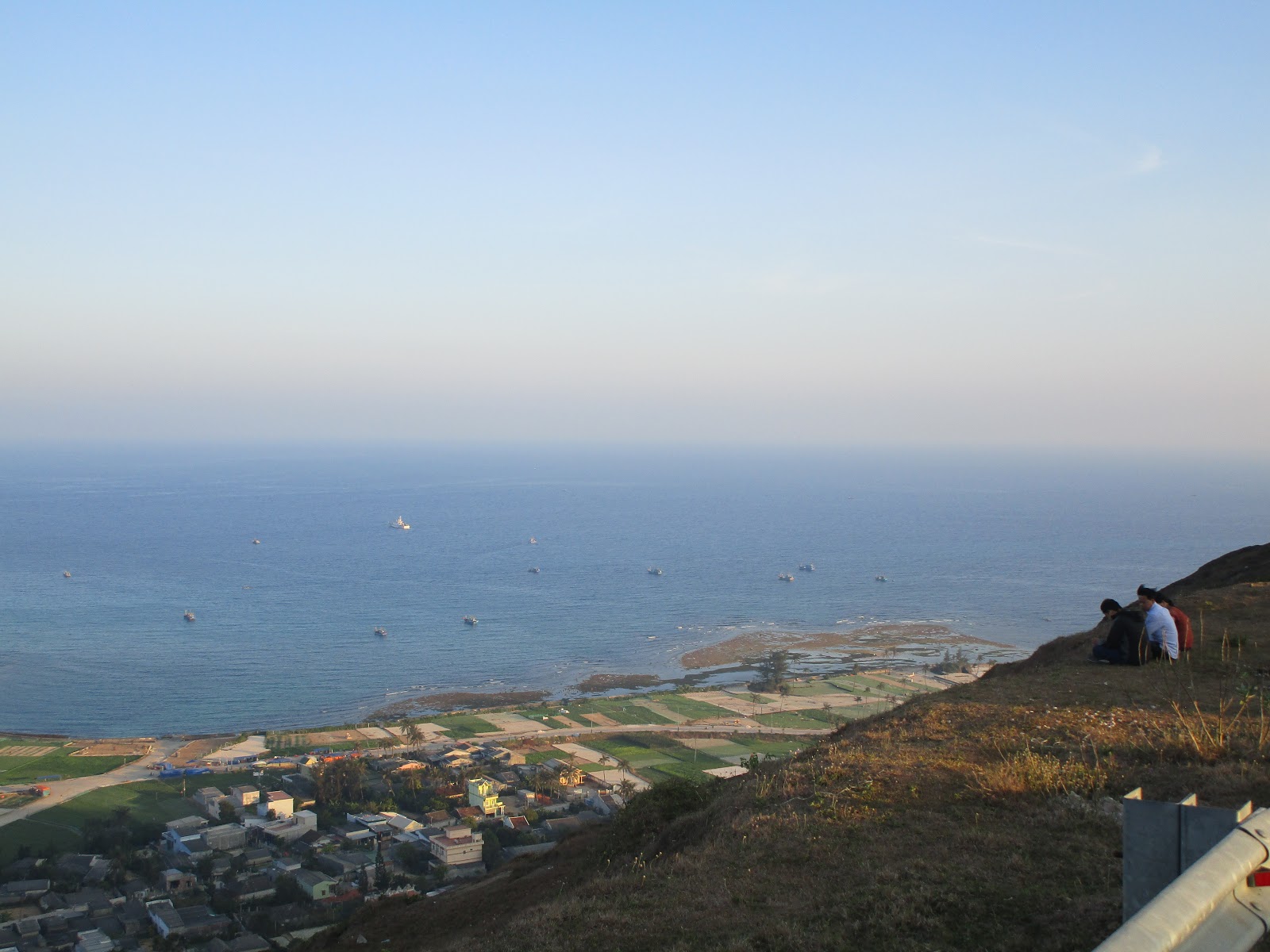
From the road, we could see a good view of the island below.

And then a view at the top.


There was also a small lake up at the top.
My wife told me the lake was natural (it had formed in what used to be the crater of a volcano). But the lake had become larger because of the dam built to preserve the water.


We then walked down again.
We got back to the scenic overlook peak. The wedding photo couple had finally left.
"Aha," I said. "We'll get our photo after all. We just had to wait them out."
"It won't look nice though," the wife said. "The sun has gone down."
And indeed, the colors were a bit subdued.


After this the sun had gone down, and it was time to walk back.
We walked back inland, and saw some of the local neighborhoods and local life of the island. No pictures though (it was all dark by this time.)
And then we got back to the hotel, and ready for the next day.


2 comments:
Quite the outing -- thanks for sharing. The church struck me. What denomination would that be, RC? Someone who needs to make a visual point, in any case.
My guess is Catholic. Catholicism is by far the dominant strand of Christianity in Vietnam. Protestant churches are almost non-existent.
Post a Comment